News & Events
Brief Introduction
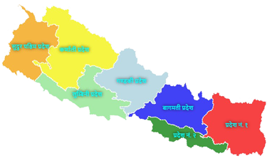
Bheerkot Municipality has been declared on 1st October 2072 by the Council of Ministers of the Government of Nepal in accordance with the provisions of Section 80 of the Local Self-Government Act 2055. Bheerkot Municipality located in a hilly area under Syangja district of Gandaki province. The headquarter Bayarghari is about 730 meters above sea level. Its lowest altitude is Changchangadi mountain at about 713 meters above sea level and Narayangiri temple at Ward No. 9 and Tamuko Lake at Ward No. 8 are at about 1735 meters above sea level. Bheerkot Municipality is bordered by Biruwa Rural Municipality and Putalibazar Municipality to the east, Parbat District to the west, Arjunchaupari Rural Municipality and Putalibazar Municipality to the north and Waling Municipality to the south.
The Bheerkot state was established between 1475 to 1500 in the Bikram Sambat within the medieval Aandhikhola civilization. In the history of Syangja, Bheerkot is considered to be an ancient historical fort and coat among Nuwakot, Sataunkot, and Gahraunkot. Jain Khan settled a place called West Khilung from Aandhikhola and nearby Bheerkot, a place with cool air, was ruled by the Thakuris with the construction of houses, temples, and Kotghar.
Located in the north of this municipality, Shankhpur extends from Bheerkot Municipality Ward No.1, to Khatrikhola in Bheerkot Municipality Ward No.4 in the south and from Bhurungkhola in Bheerkot Municipality Ward No.3 to the west to the border of Kalikakot Mountain District in Bheerkot Municipality Ward No.9.
Total Population: 22645 (Male: 10267 Female: 12378) As per National Census 2078
Districts included: Bheerkot Municipality and Changchangdi (2,3,7,8,9), Swarek (1,5,6,7,9) and Kalikakot (3-8) VDCs
Total Area: 78.23 (Sq. Km.)


